Area information
Area description and directions to the main attractions for Mama Shelter London.
- London, England, UK (LCY-London City) - 5.18 mi - Get directions »
- London, England, UK (BQH-Biggin Hill) - 14.37 mi - Get directions »
- London, England, UK (LHR-Heathrow) - 17.22 mi - Get directions »
- London, England, UK (LGW-Gatwick) - 26.36 mi - Get directions »
- London, England, United Kingdom (LTN-Luton) - 27.54 mi - Get directions »
- London, England, UK (STN-Stansted) - 28.27 mi - Get directions »
- Southend-on-Sea, England, UK (SEN-Southend Municipal) - 32.82 mi - Get directions »
- Farnborough, England, UK (FAB) - 35.31 mi - Get directions »
- Cambridge, England, UK (CBG) - 47.95 mi - Get directions »
- Cambridge Heath Train Station - 1,031 f
- Bethnal Green - 0.42 mi
- Bethnal Green Railway Station - 0.58 mi
- London Fields Train Station - 0.58 mi
- Shoreditch - 0.75 mi
- Whitechapel - 0.86 mi
- Stepney Green - 0.96 mi
- Hackney Central Railway Station - 1.06 mi
- Hackney Downs Station - 1.13 mi
- Old Street Station - 1.17 mi
- Old Street - 1.22 mi
- Aldgate East - 1.26 mi
- Dalston Kingsland Railway Station - 1.28 mi
- Homerton Train Station - 1.31 mi
- Mile End - 1.32 mi
- Bethnal Green Museum of Childhood - 0.24 mi
- Association Gallery - 1.04 mi
- Whitechapel Arts Gallery - 1.17 mi
- Whitechapel Art Gallery - 1.32 mi
- Victoria Park - 0.46 mi
- Wiltons Music Hall - 0.92 mi
- Dennis Severs House - 0.92 mi
- Israel Zangwills House - 0.99 mi
- Christ Church Spitalfields - 1.05 mi
- Broadgate Ice Rink - 1.16 mi
- Old Street - 1.17 mi
- London Liverpool Street - 1.28 mi
- Hackney City Farm - 0.20 mi
- Columbia Road Flower Market - 0.38 mi
- Bethnal Green - 0.44 mi
- Maureen Paley Interim Art - 0.55 mi
- Shoreditch - 0.77 mi
- Brick Lane - 0.82 mi
- Vilma Gold - 0.86 mi
- Whitechapel - 0.89 mi
- Vibe Bar - 0.89 mi
- Hoxton Square - 0.89 mi
- Lux Centre - 0.92 mi
- White Cube - 0.93 mi
- Stepney Green - 0.95 mi
- Old Spitalfields Market - 1.05 mi
- The Spitz - 1.06 mi
- Hackney Central - 1.07 mi
- Hackney Empire - 1.12 mi
- Soup Kitchen for the Jewish Poor - 1.15 mi
- Aldgate East - 1.24 mi
- Dalston Kingsland - 1.26 mi
- Petticoat Lane Market - 1.27 mi
- Mile End - 1.30 mi
- Institute of International Visual Arts - 1.32 mi
Airports Show all on map »
Transport
Train stations Show all on map »
Museums
Art Galleries Show all on map »
Other attractions
National Parks Show all on map »
Theatres Show all on map »
Historical Buildings Show all on map »
Things to do Show all on map »
Famous Streets Show all on map »
Other Show all on map »
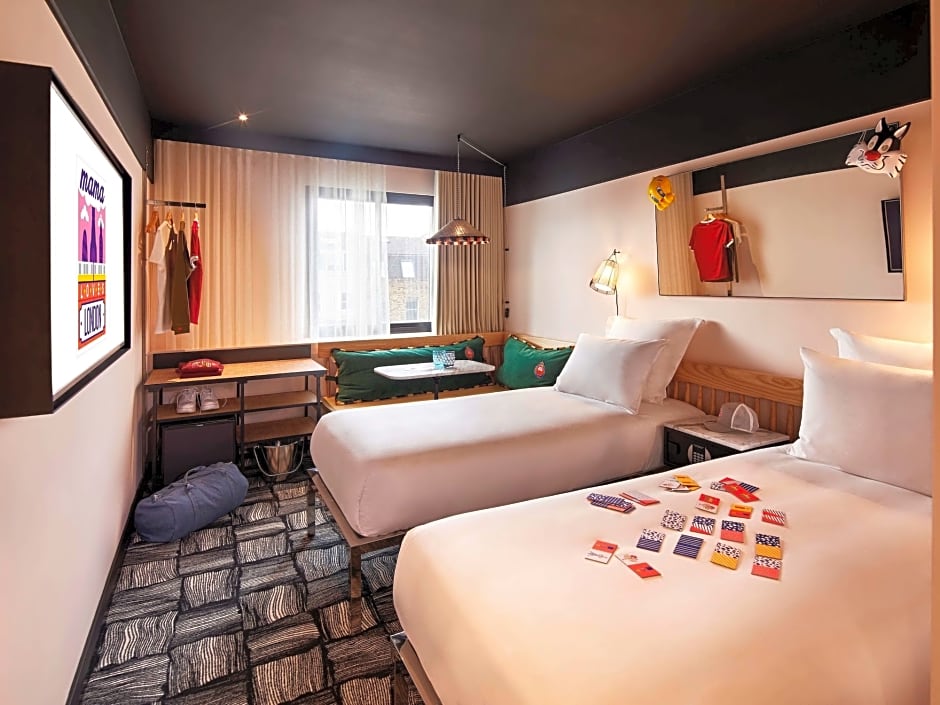
Mama Shelter London
437 Hackney Road, London, E2 8PP, United Kingdom
Mode of travel
Unable to get a route
Reverse Directions »
View all photos in gallery